Rockwall Trail

Quick Facts:
Drive time from Banff: 45 minutes
Mileage: 34 miles, point-to-point
Elevation gain: ~6,000 feet
Activity: Backpacking
Estimated time: 4-5 days
Reservations & Fees Required: https://reservation.pc.gc.ca/

Source: Parks Canada
There is a pretty small weather window to do this trail with the high altitude, and they won’t allow you to make reservations until the campsites are cleared of snow. This trail is also known to close for wildfires, so please pay attention to that.

If you’ve never had the chance to do a Canadian backpacking trip, add it to your bucket list right now. These trails are some of the most well-maintained, “luxurious” trails that I’ve ever been on. The campsites are all established with tent sites, bear bins, outhouses, and sometimes picnic shelters. The trails are easy to follow, often with signage along the way, and it’s likely you’ll run into a park ranger. Since you have to reserve each individual campsite, be sure to have your itinerary planned ahead of time. Also, I would recommend printing out your reservation confirmation as rangers will check them.

We started at the Paint Pots trailhead and hiked south to the Floe Lake trailhead. This allowed us to start out easier and have less elevation gain overall. We decided to hitchhike at the beginning and drop our car off at the end before we started hiking. Hitchhiking was fairly easy, and the two trailheads are only about 10 minutes apart.

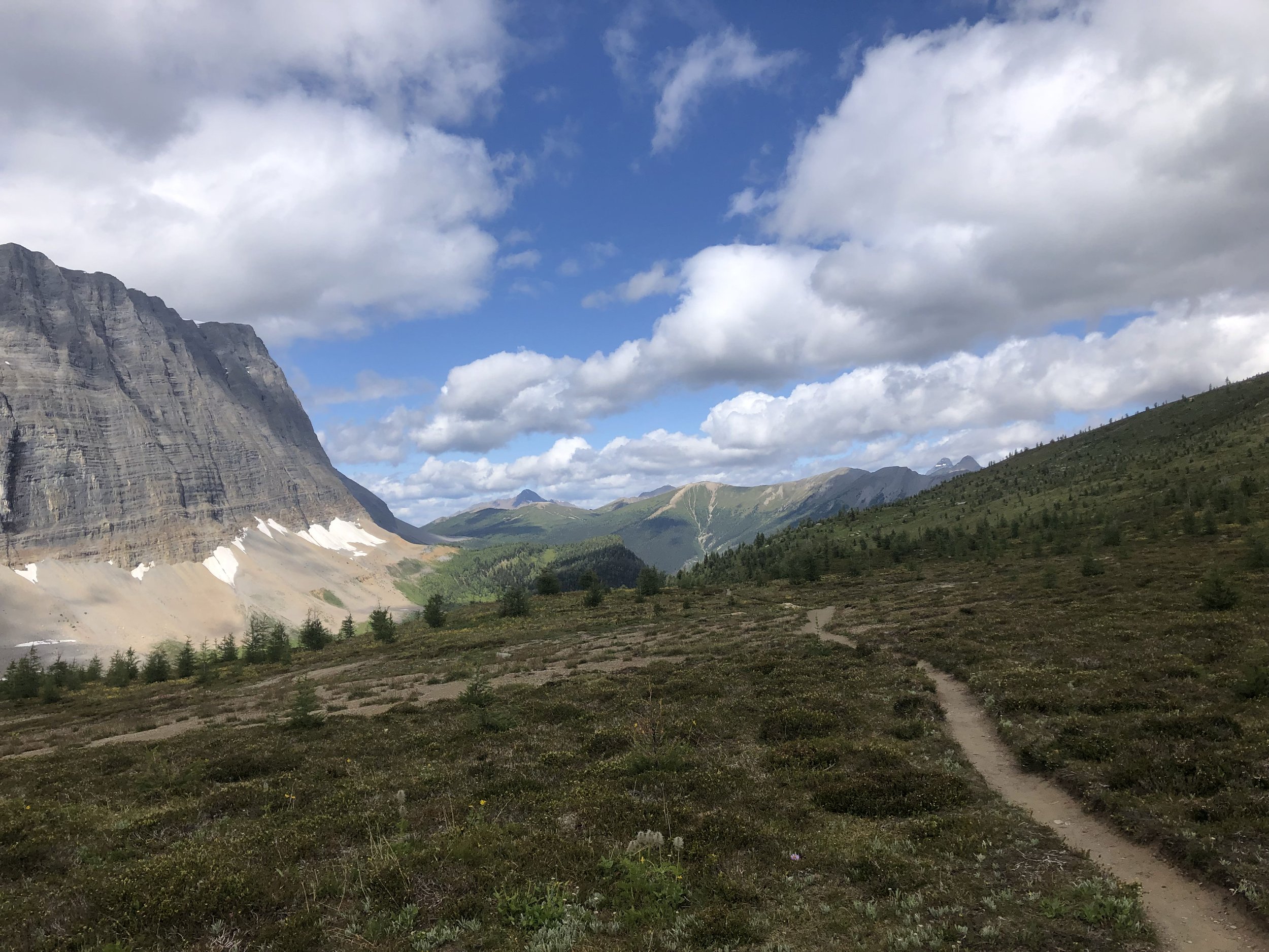
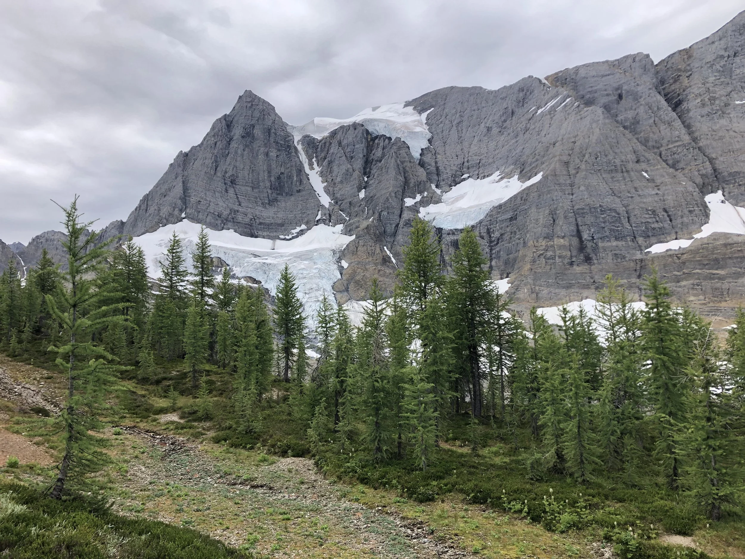
The highlight of this trail was the sheer size of the walls and mountains constantly surrounding you. This was one of my favorite pictures from the trip, taken at Helmet Falls Campground. You could walk to Helmet Falls (one of the largest in Canada) about 1/2 mile from the campground, a side trip from the normal trail.
Shortly after leaving Helmet Falls Campground, you’ll start ascending towards Rockwall Pass. This is a lot of elevation gain, but is the only pass for the day if camping at Tumbling Creek Campground like we did.
Day 3 of hiking was our shortest day at only 5 miles, but it did contain another pass with over 1,000 feet of elevation gain: Tumbling Pass. This day we hiked through mostly alpine meadows, but as you descend towards Numa Creek, the trail becomes a bit overgrown.

Along with the magnificent walls, this trail had beautiful glacier-fed rivers, well-crafted bridges, large waterfalls, and tons of beautiful wildflowers.

We were unable to book Floe Lake Campground, so our final day was spent hiking from Numa Creek Campground to the Floe Lake Trailhead. This was 12 miles in total, starting the morning with 2,500 feet elevation gain up and over Numa Pass, the 3rd and final pass of the trip. Once you get to Floe Lake, it’s 6 miles of downhill. This was not the ideal itinerary, but it ended up being manageable. If you have 5 days, I would recommend getting a site at Floe Lake Campground. If you only have 4 days, it would probably be easier to bypass Numa Creek Campground.